
JUNE 26, 2020 — Associate professor of geography Nazgol Bagheri has always been fascinated by the complexity of cities. Whether she was using public transportation growing up in her native Tehran, Iran, or riding the subways and trams of Tokyo and Zurich during her studies of architecture and urban planning, she loved watching the cities morph from one neighborhood to the next.
These days, she uses geographic information systems to map the relationship between urban planning and social anthropology in those cities—from where women can move freely in Tehran to the geographic patterns of multilingualism in the United States. As director of UTSA’s GIS Lab, she also teaches students how to use GIS to answer their own pressing research questions.
Bagheri discusses her research interests, how geography scholars have shifted gears during the pandemic, and some of the most ingenious ways GIS has been used at UTSA.
You were trained as an architect and urban planner as a graduate student at the National University of Iran in Tehran. How did your interests shift more toward geo-ethnography over time?
I actually wanted to be a physicist at an early age. I was initially inspired by the Italian theoretical physicist Ettore Majorana’s genius and mystery. But I ended up being an architect and later converted to be a geographer, which is a bit of both art and science. The interdisciplinary approach we take in geographic research enables us to think about spatial design and organization, and about the form and aesthetics, but more importantly about the politics of the places we live in. I became interested in questioning why cities function the way they function.
I also spent three years at a consulting engineering firm in Iran, where I was an urban planner and GIS analyst working on housing projects in the Persian Gulf region. Through that opportunity, I was introduced to not only the unnerving politics concerning distribution between public versus private funds for our architectural projects but also to the more tangible, on-the-ground politics of gender, ethnicity, and class in southwestern Iranian provinces, where Sunnis and Arabs are the majority. To that end, I decided to focus on geo-ethnographies of public spaces and to study the interplay of gender and space politics in modern and traditional public spaces in the socially and spatially segregated city of Tehran for my doctoral and postdoctoral works.
You’ve been an instructor of feminist geography courses for both undergraduate and graduate students here at UTSA, and your research revolves around that topic. What makes it an important area of study?
As a female architect, I have always been interested in the role of gender in designing and experiencing buildings, public spaces, and cities. I particularly enjoy feminist geography because of its commitment to societal change. I see feminist geography as a venue to echo the voice of many minority groups, including women, as well as an opportunity to value human complexity and diversity. My own feminist research trajectory started with a focus on Tehran to study contemporary formations of Muslim femininity during a time when being a Muslim woman is a highly contested geopolitical theme.
You have a couple of book projects in progress: On the Move: Gendered Mobilities in Urban Global South and Mapping Women in Tehran: Rethinking Gender Identities & Space Politics. What drew you to those subjects?
In both of these books I am focusing on the roles gender play in social and physical space constructions. The first book, Mapping Women in Tehran, examines the processes in which women use and attach meaning to the built environment through everyday spatial practices in selected urban public places. The book fills a scholarly gap between significant fields of study in feminist geography, including the sociocultural re- and deconstruction of public spaces and gendered identities. It will be highly visual, multidisciplinary book in which I explore the interplay of gender, place, and religion in Tehran to examine the ways in which local culture affects and is affected by the design of public spaces.
The second book is an edited volume bringing together scholars from different disciplines to share their research on gender and mobility in cities around the world. Most examples are coming from the global south where there is less research on such a theme in the English language.
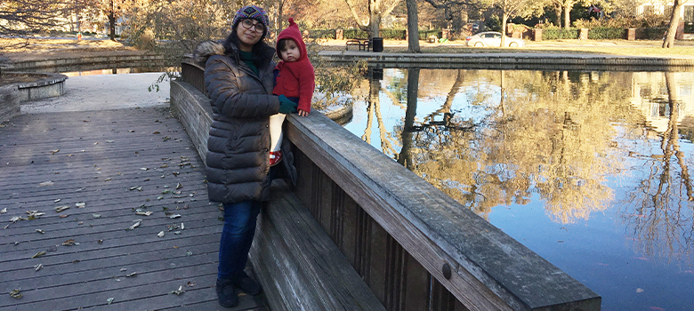
Bagheri and her daughter, Darya, enjoy their favorite park.
You also wrote a paper titled “Geographic Patterns of Language and Bilingualism in the United States.” What were some key takeaways from that research?
More Americans are bilingual than ever before, not only residing in large metropolitan areas but also widely dispersed in rural counties. We used GIS mapping to show counties where 10% or more of the residents age 5 and older speak a language other than English at home. We discussed the current geographic patterns of language in the United States. We built upon Mackey’s three concepts of geolinguistics—power, attraction, and pressure—and explained why immigrant-language minorities usually shift over three generations from monolingualism in their native language to bilingualism and finally to monolingualism in English.
How has your research changed since the coronavirus pandemic swept over the globe?
The pandemic has indeed affected where we work, where we play, and where we rejuvenate and meditate. The pandemic has redefined our relationship with actual space and made us more aware of space politics. We are hearing about hotspots, urban density, distance, spread, scale, proximity, and injustice. These are all fundamental geographic concepts! On a more social level, the pandemic has its own injustice, since it has affected people of color more in the U.S. Hence, we can say, with some tragic clarity, why where is so fundamental to our experience in life and during the pandemic.
In my case I will be contributing to two book projects: COVID-19 and an Emerging World of Ad Hoc Geographies and a second book edited by a colleague called Race Wars: Disparity Politics During COVID-19. Collaborating with a colleague in Iran, we will be studying the geographies of the pandemic and its consequences in Tehran for the first book. For the second book I will focus on gender and explore what the pandemic tells us about gender inequality in Texas.
What is GIS and how have you applied it in your research?
GIS is a computer software in which we map, measure, monitor, model, and manage spatially referenced data. GIS allows users to visualize, question, analyze, interpret, and overlay data layers to understand relationships, patterns and trends.
I combine different layers of both qualitative and quantitative data in GIS in order to get a more realistic picture of what is happening. This method is called qualitative GIS or geo-ethnography. My GIS application draws on insights from my fieldwork studying Iranian women’s socio-spatial behaviors in Tehran’s public spaces. I link photographs, sketches, and interview narratives to the geographical data gathered from the Iranian Census Organization, National GIS Database, and Tehran Municipality.
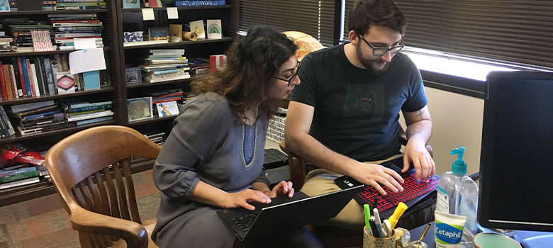
Bagheri works with graduate student Zane Nordquist in her office.
Students from several different majors have enrolled in GIS courses—from criminal justice and urban planning to sociology and environmental science. What are some of the most innovative ways in which you, as the GIS Lab’s director, have seen UTSA students use GIS?
That is why teaching GIS Lab is one of my favorite things to do. Our students in GIS often are coming not only from different majors but also with diverse research interests and backgrounds. This is quite valuable to my class as students choose and define their very own GIS questions and final projects. Every single semester I learn something new from students in the GIS Lab. The technology has a diverse set of applications to engineering, planning, management, transportation, insurance, telecommunications, and business. It also helps users make better decisions about locations, including real estate site selection, route selection, emergency planning, conservation and natural resource extraction.
Several students have happily surprised me with their outside-the-box thinking on GIS applications. I had a student who studied the relationship between racial and ethnic enclaves and the location of food deserts in San Antonio. Another studied how the state political affiliation related to the LGBTQ rights and hate crimes against minorities. Another student analyzed the linkages between hydraulic fracturing wastewater injection and the increase of earthquakes in Oklahoma, looking at a huge data set and different types of data while considering sociopolitical aspects and human-environmental consequences of fracking. The list goes on.
One geography student, Kirstin, examined the 2006 Lebanon War—an event of personal significance in her family. Kirstin wanted to investigate the location of air strikes during the conflict and their effects on surrounding communities; this would prove to be no easy task because obtaining geographic data from foreign countries is often very difficult. Luckily, we were able to help Kirstin locate and secure data sets from international and Lebanese agencies. In the end she produced a detailed series of maps showing the harsh effects of these air strikes.
You have either won or been nominated for multiple teaching awards. What qualities do you feel have made you an effective teacher?
I believe that passion for the subject and love of students are necessary components of successful teaching. I try to transform these passions into an interactive process of the creation and internalization of knowledge. My love of teaching derives from my teaching philosophy of personalized and democratic education in which all students, including less-privileged students, get a chance to learn and shape their own futures.
I saw that love in my first grade teacher who kept me motivated, even in the middle of the Iran-Iraq War. Mrs. Panahi kept coming to class with a smile on her face every single day while Tehran was being heavily bombarded. Finally, on a cold autumn day in 1986, our school got attacked and closed. Mrs. Panahi held alphabet and math lessons in her house, where she served us warm baklava, teaching us A comes before B and light comes after darkness. Since then, I have had some great teachers, but the seeds of hope—and the power to change for better—that were planted in my young mind still stay with me to this day as I try to pass that on to my students.
UTSA Today is produced by University Communications and Marketing, the official news source of The University of Texas at San Antonio. Send your feedback to news@utsa.edu. Keep up-to-date on UTSA news by visiting UTSA Today. Connect with UTSA online at Facebook, Twitter, Youtube and Instagram.
Move In To COLFA is strongly recommended for new students in COLFA. It gives you the chance to learn about the Student Success Center, campus resources and meet new friends!
Academic Classroom: Lecture Hall (MH 2.01.10,) McKinney Humanities BldgWe invite you to join us for Birds Up! Downtown, an exciting welcome back event designed to connect students with the different departments at the Downtown Campus. Students will have the opportunity to learn about some of the departments on campus, gain access to different resources, and collect some giveaways!
Bill Miller PlazaCome and celebrate this year's homecoming at the Downtown Campus with food, games, giveaways, music, and more. We look forward to seeing your Roadrunner Spirit!
Bill Miller PlazaThe University of Texas at San Antonio is dedicated to the advancement of knowledge through research and discovery, teaching and learning, community engagement and public service. As an institution of access and excellence, UTSA embraces multicultural traditions and serves as a center for intellectual and creative resources as well as a catalyst for socioeconomic development and the commercialization of intellectual property - for Texas, the nation and the world.
To be a premier public research university, providing access to educational excellence and preparing citizen leaders for the global environment.
We encourage an environment of dialogue and discovery, where integrity, excellence, respect, collaboration and innovation are fostered.